Indiramma Illu House Geo Tagging Process Explained for 2026
If you are building a home under the Indiramma Housing Scheme in Telangana, you may have heard about something called geo tagging process . It sounds technical, but don’t worry — it’s actually a simple step in the house construction process.
This guide will explain what geo tagging is, why it is required, how it works, and easy tips to help you complete it without stress. Learn what Geo Tagging Process means in the Indiramma Housing Scheme, why it is required, how it works, documents needed, and tips for successful verification.

What Is Geo Tagging in Indiramma House Construction?
Geo Tagging Process is a way to mark the exact location of your house plot using GPS coordinates.
When officials visit your site, they use the Indiramma Indlu mobile app to take a photo and record the geo coordinates (latitude and longitude). This proves that the house is being constructed where you said it would be.
This is done for monitoring and transparency so that the government can make sure funds are released only for real construction work. The app used by officials captures the location and progress, like how the construction is going stage by stage.
Why Geo Tagging Is Important
Geo Tagging Process matters because:
It confirms your plot location officially.
It is checked before releasing construction funds.
It helps officials track progress stage by stage.
It prevents mistakes and misuse of money.
Without geo tagging, the next fund installment for house construction may not be released. Geo tagging is part of making sure the scheme stays fair and the money goes only to real construction work.
When Does Geo Tagging Happen?
Geo tagging happens at specific stages of construction, usually during official inspections.
These stages include:
At each stage, officials visit the site, take geo tagged photos and update the progress in the app.
This means your house location and progress are recorded digitally by the authorities.
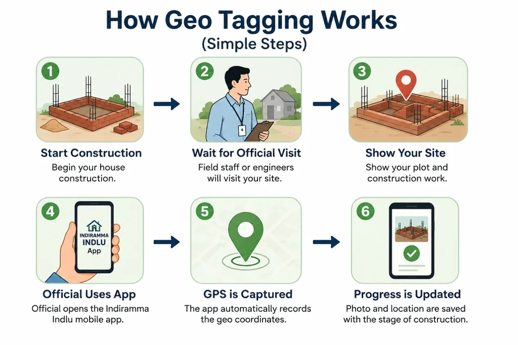
How Geo Tagging Works (Simple Steps)
Here’s the process in plain words:
Start construction
Once your house is sanctioned and you begin work, get ready for the geo tagging step.
Wait for official visit
Field staff or assistant engineers from the housing department will visit your house site.
Show your plot and construction work
Let them know where the foundation or wall stage is happening.
Official uses app
The official opens the Indiramma Indlu mobile app and takes a photo of your site.
GPS is captured
The app automatically records the geo coordinates of the location.
Progress is updated
The photo and location are saved with the stage of construction.
This information is then sent to the system for verification and fund release.
Quick Tips to Make Geo Tagging Smooth
Here are friendly tips so you don’t run into trouble:
Make sure your site is easy to see and identify.
Try to be at the site during inspection.
Keep your sanction order and Aadhaar handy.
Officials may schedule visits based on construction stages.
After geo tagging, check with the official if everything was updated correctly.
If geo tagging is done properly, the next installment of funds usually gets released smoothly.
What If Geo Tagging Doesn’t Happen?
Sometimes officials might delay the visit or a mistake may happen.
If Geo Tagging Process is not done:
Call or visit your local MeeSeva Centre or Gram Panchayat Office.
Ask the housing department official responsible for your area.
Request a scheduled visit for geo tagging.
Make sure you keep a note of your application ID and sanction details so you can follow up easily.
Common Mistakes to Avoid
These common errors can slow down geo tagging:
Not starting construction on time.
Plot area being blocked or unclear.
Wrong plot location shown to the official.
Missing sanction order or documents.
Not being available at the site during inspection.
Avoid these small mistakes to save time and avoid unnecessary delays.
How Geo Tagging Helps You
Geo tagging isn’t just for officials — it also helps you because:
Helpful Reminder:
Always track your application ID and keep documents safe. If anything is unclear during the process, don’t hesitate to ask officials for guidance. smooth geo tagging process helps you finish your house without delay
FAQs About Geo Tagging Process
Conclusion
Geo tagging may sound technical, but it’s just a way of showing the exact location of your house to the officials and the system.
Always prepare for geo tagging by keeping your plot ready, staying at the site during visits, showing clear construction progress, and asking for help when needed.
If you follow these simple steps and tips, the geo tagging process will be smooth, and your house construction will stay on track.